
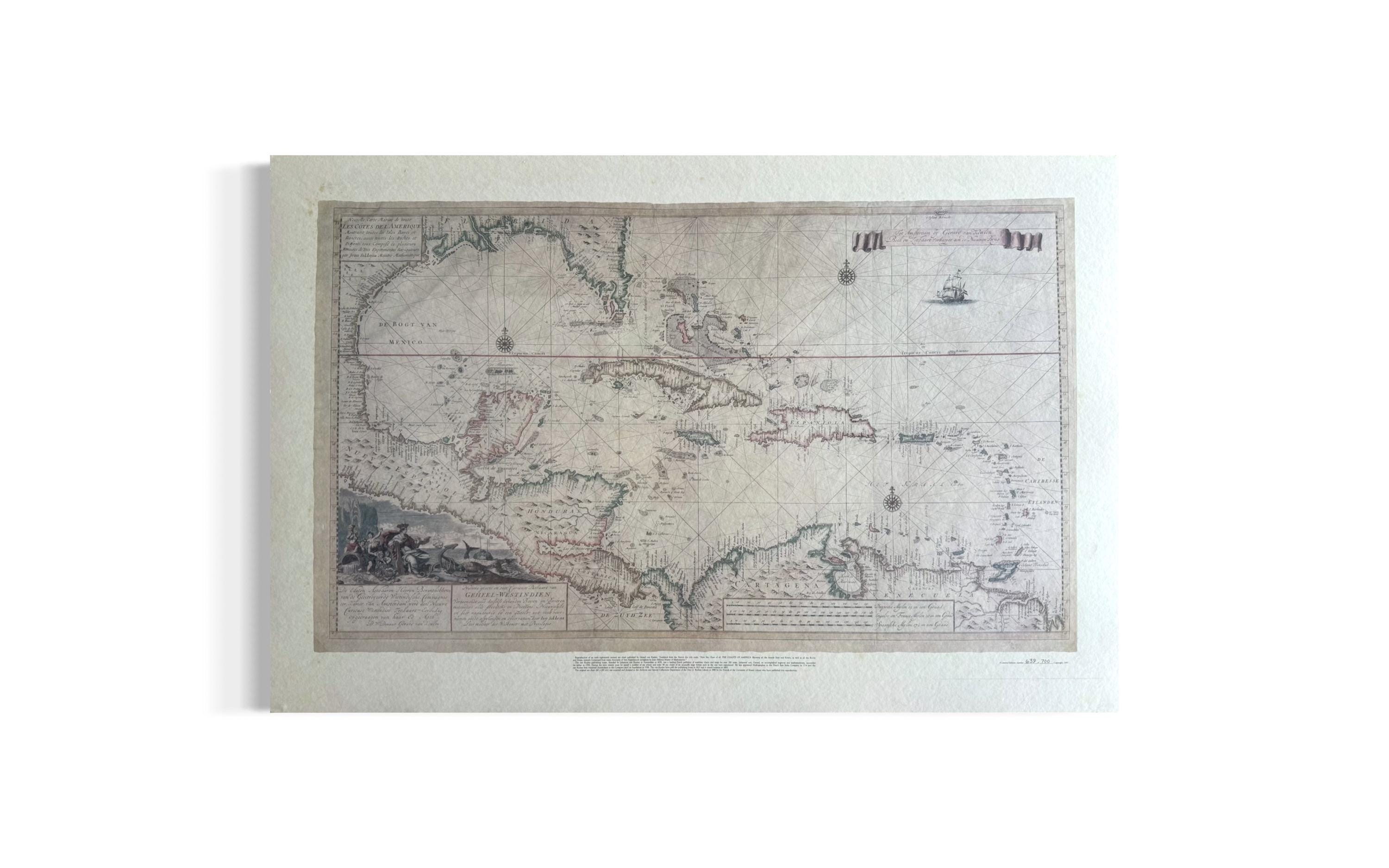
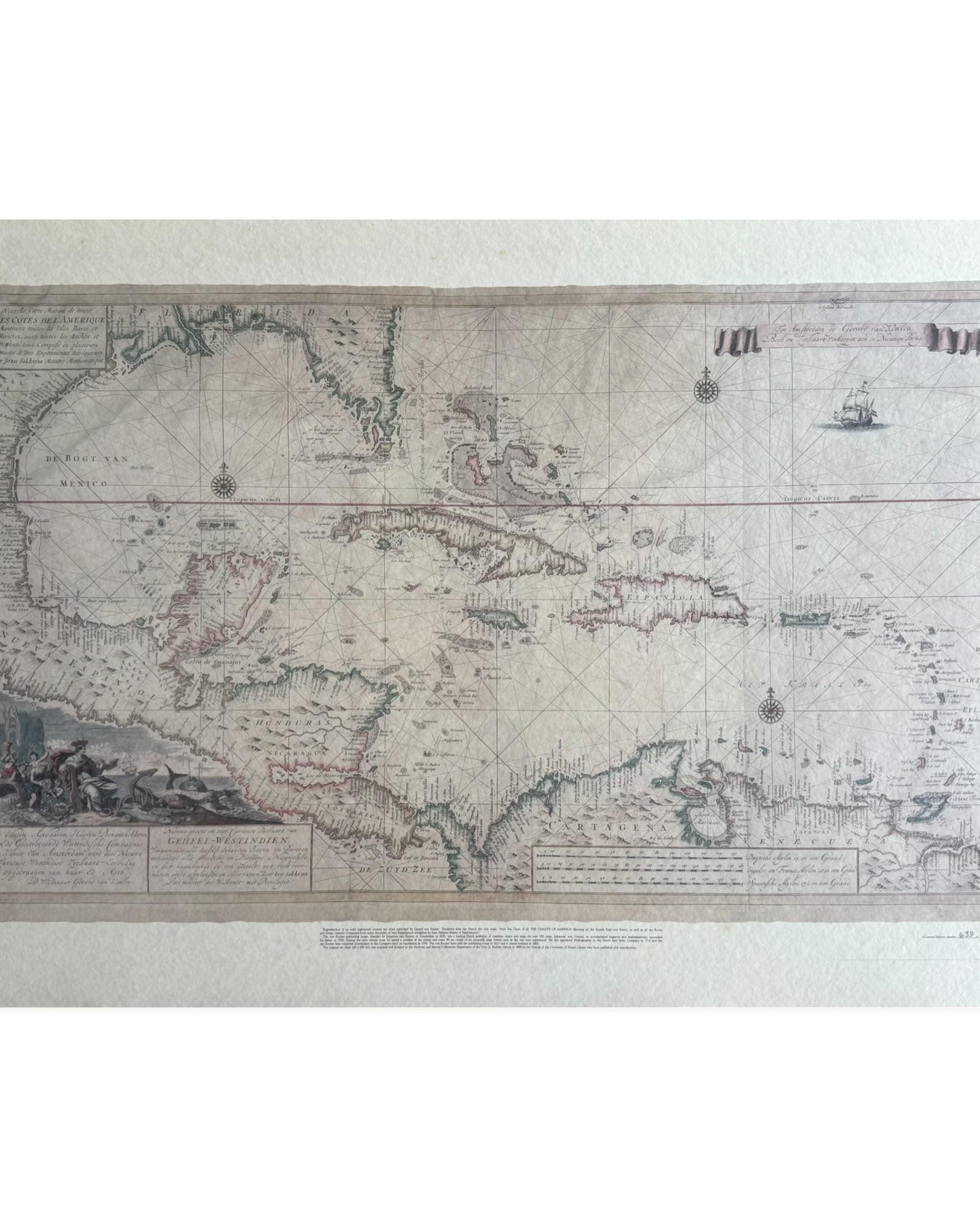
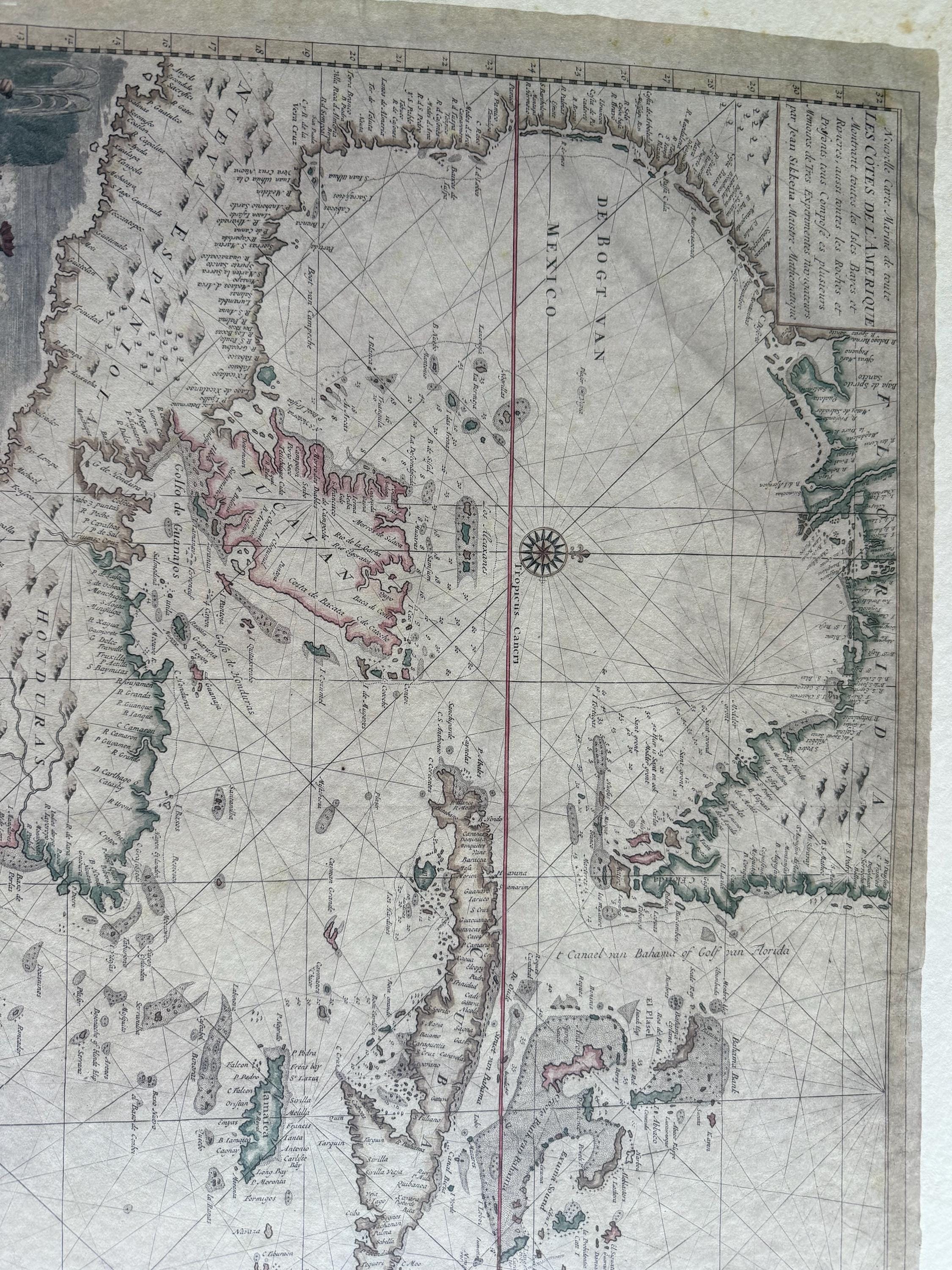
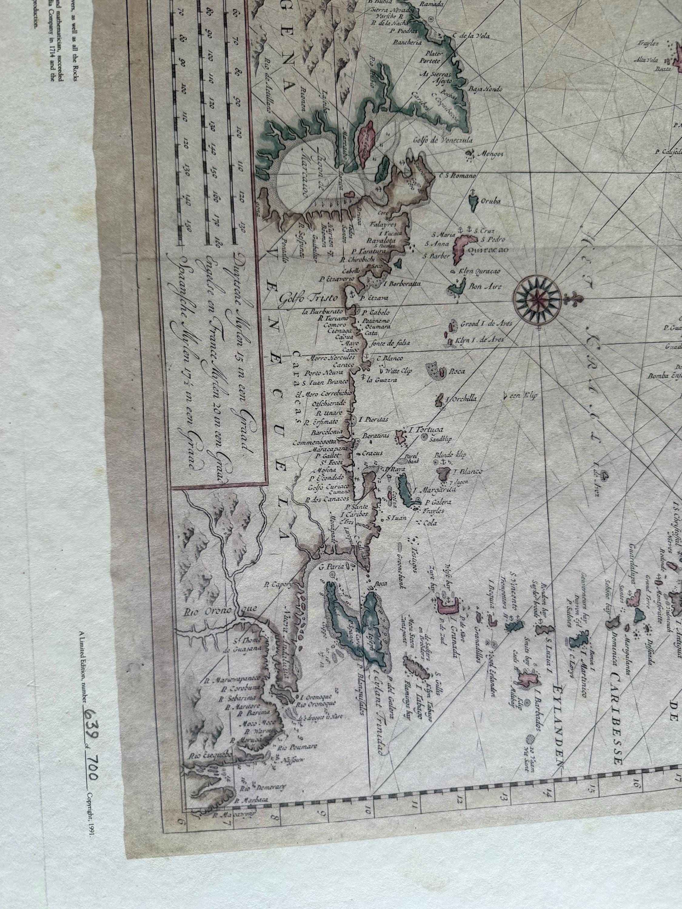
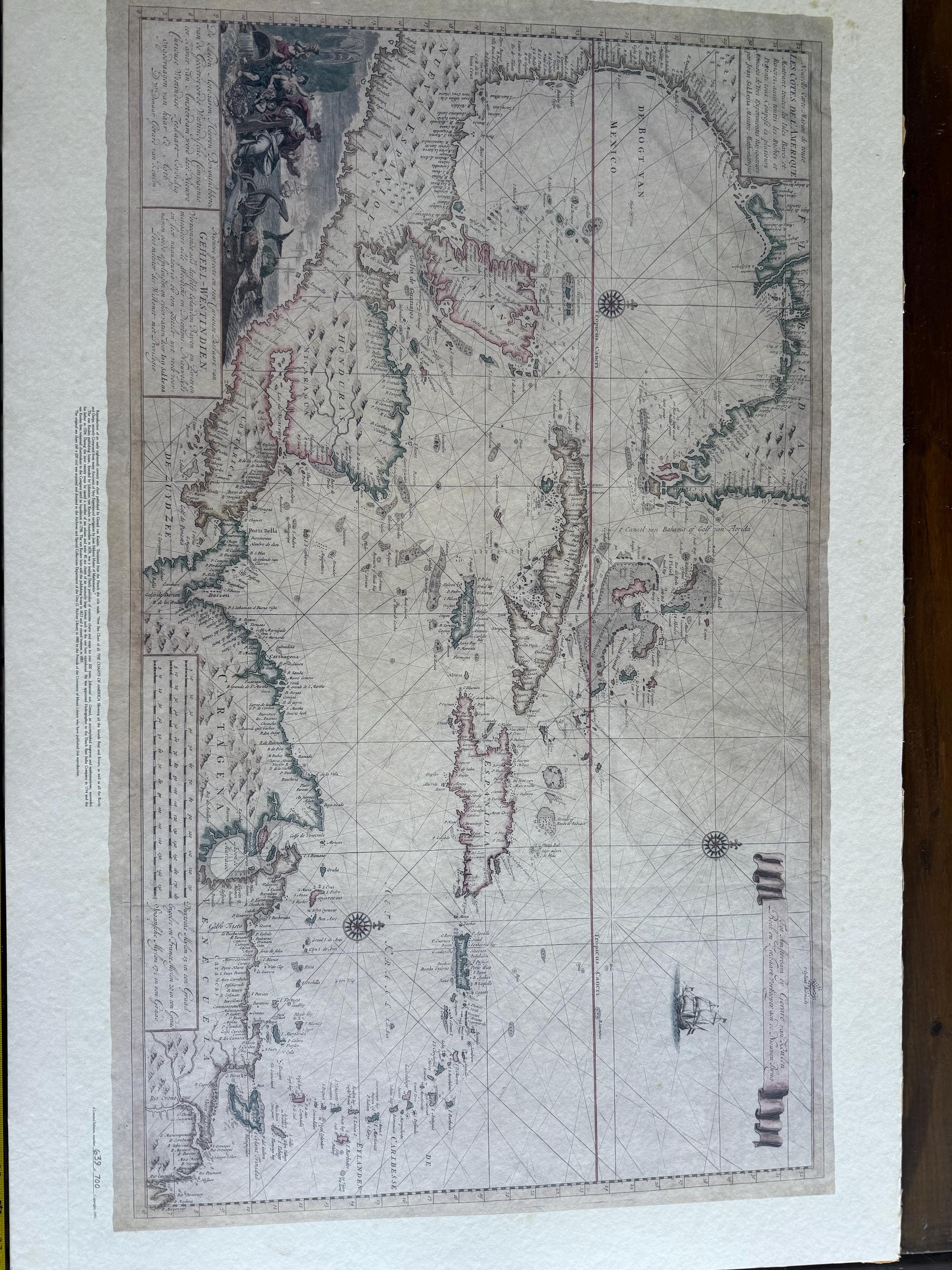
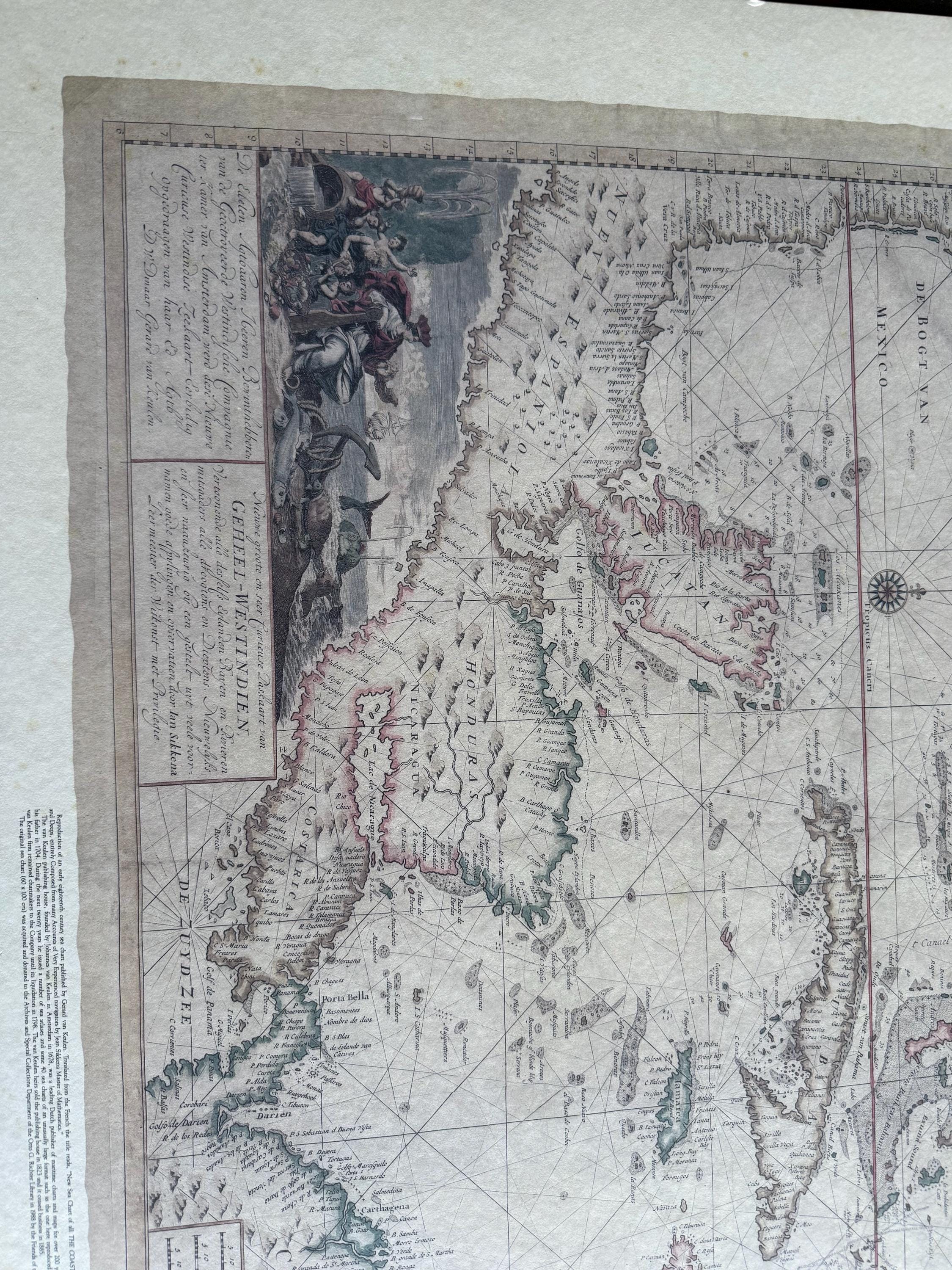
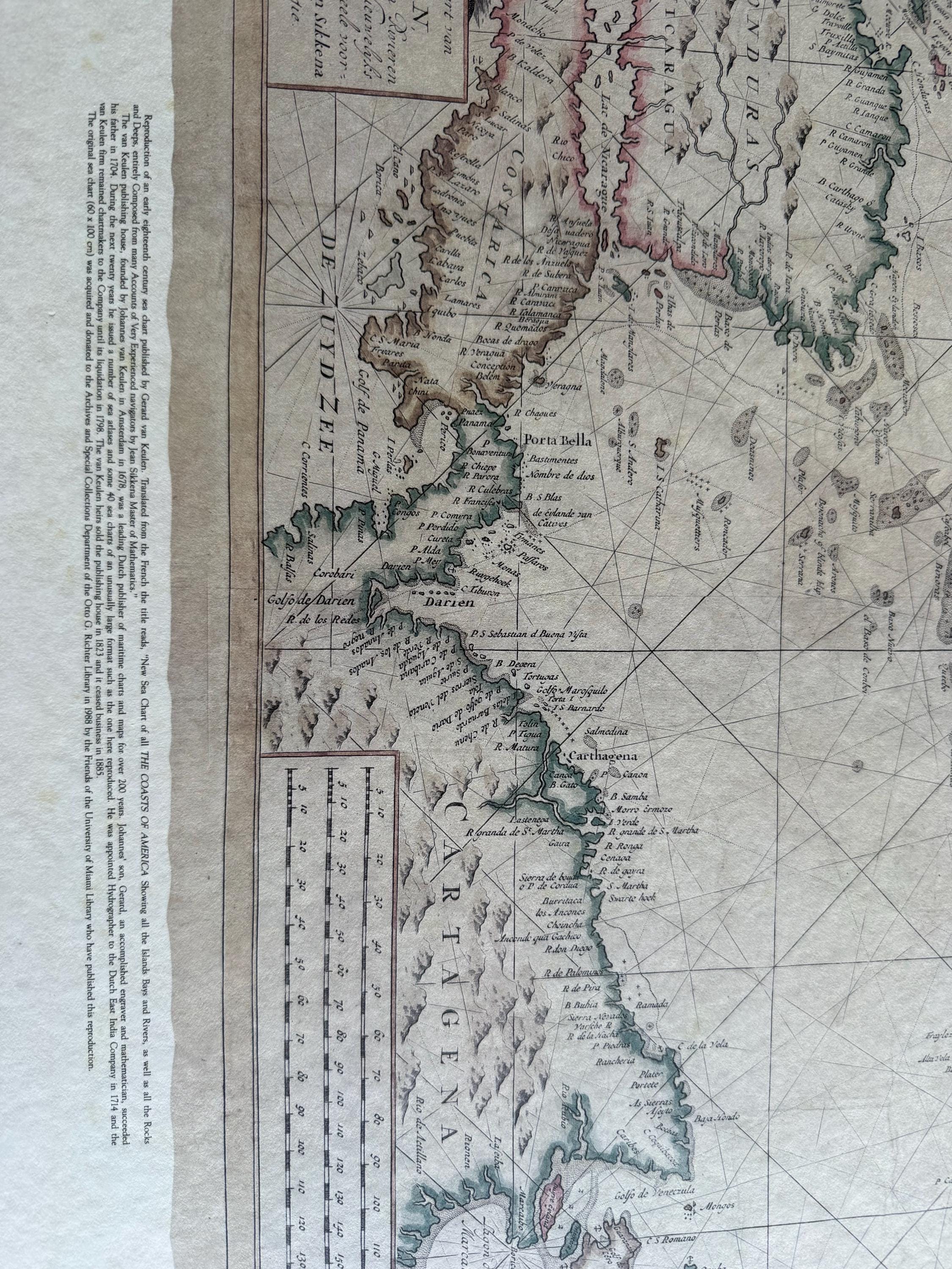
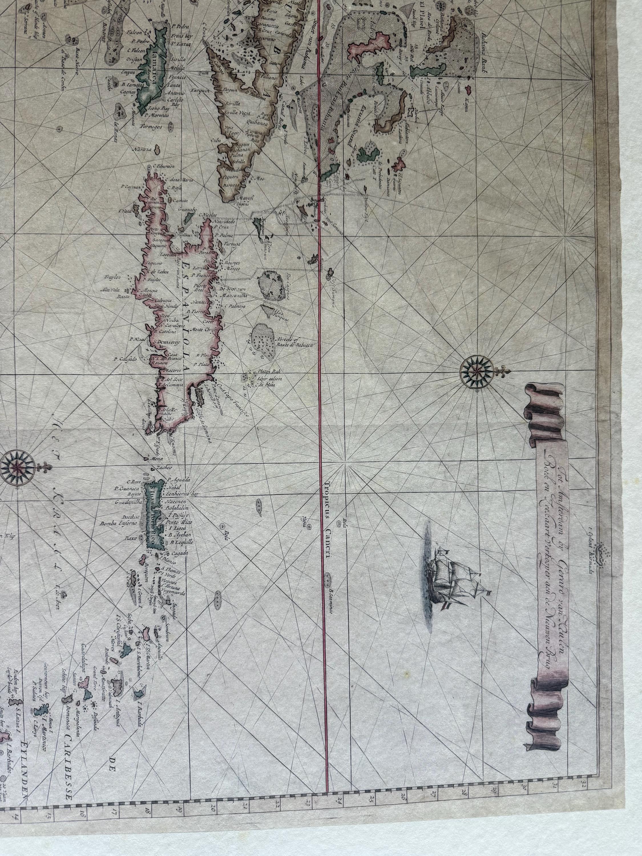
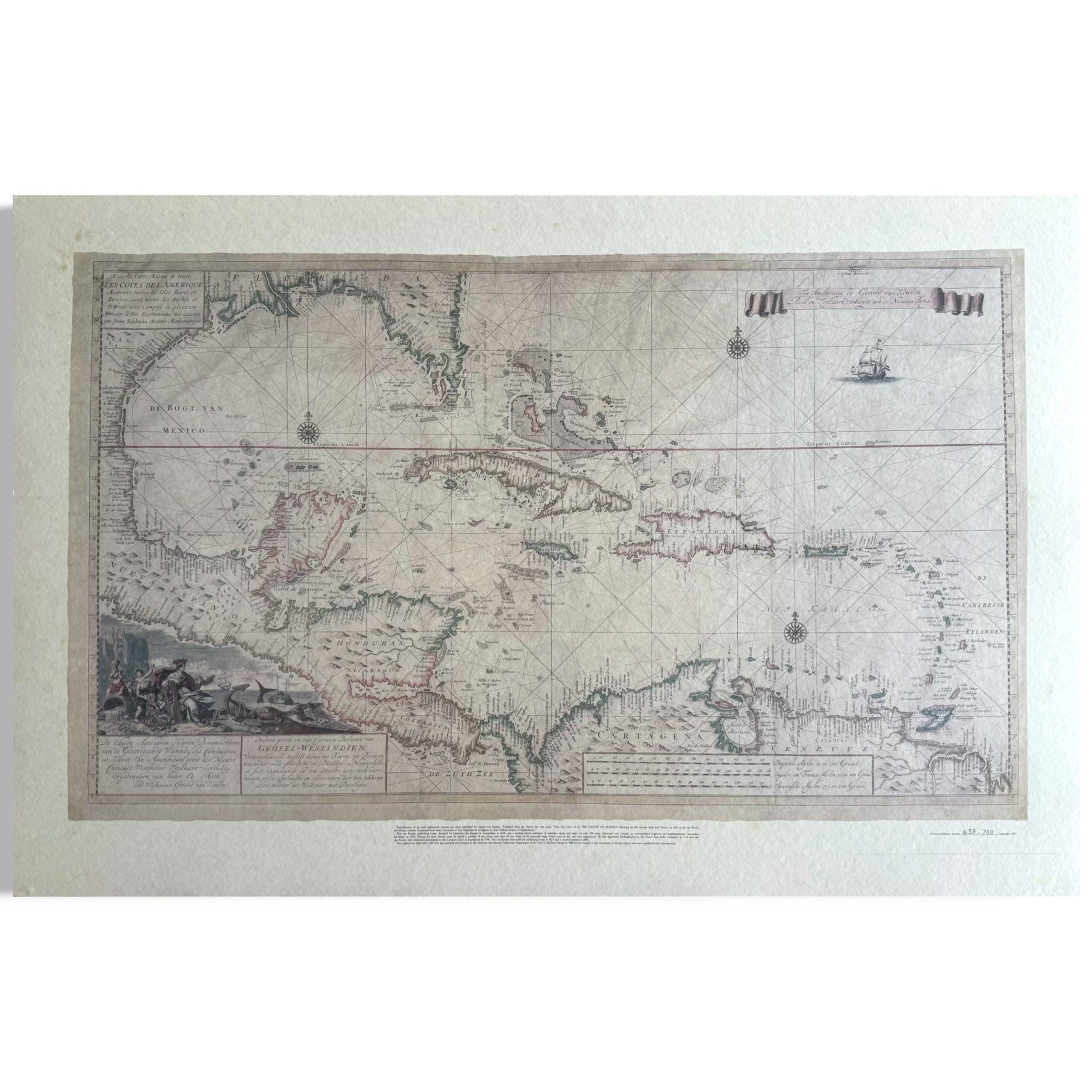
Rare 18th Century Sea Chart of West Indies by Gerard Van Keulen Limited Edition
$199.00
Ask a question
A Limited Edition, number 639 of 700 Copyright, 1991. Written Below “Reproduction of an early eighteenth century sea chart by Gerard van Keulen. Translated from the French the title reads, “New Sea Chart of all THE COAST OF AMERICA Showing all the Islands Bays and Rivers, as well as all the Rocks and Deeps, entirely composed from many Accounts of Very Experienced navigators by Jean Sikkena Master of Mathematics. “
“ The original sea chart (60 x 100 cm) was acquired and donated to the Archives and Special Collections Department of the Otto G. Richter Library in 1988 by the Friends of the University of Miami Library who have published this reproduction. “
The product is a vintage reproduction of a nautical map of Florida, the Gulf Coast, Caribbean, and Central America, dating back to 1728. Engraved using a copper plate printing technique, this map offers a unique and detailed depiction of the region from the early 18th century. Perfect for collectors or those interested in historical cartography, this piece provides a valuable glimpse into the geography and naval activities of the time period between 1700-1799.